Category Archives: Geoscience

Samples from the 20km2 Hills Intrusive Centre

Samples taken on a regular 500m by 250 m grid at the 20km2 Hills Intrusive Centre in the last three days. A High-Sulphidation alteration ecosystem. It is one of the 6 or so intrusive canters within the ~200km2 Khvav intrusive cluster all of which shows strong to advanced argillic alteration and vuggy silica.

This large alteration system is coincident with a large gravity anomaly which lies with a large 3,000 km2 gravity low which we interpret to be a large batholith in the mid crust. These gravity features are evident in a 48,000km2 airborne gravity data set and less evident in the 2.5 million km2 satellite gravity data collation we have acquired and reprocessed.

SWIR has detected alunite, pyrophyllite, diaspore, white mica, dickite and minor topaz in rocks from this area, indicative of hydrothermal fluids with temperature locally >300 °C. Alunite in this area is sodic rich.

A Miarolitic Cavity in Section

Siem Reap has 98km of new roads  and new sidewalks much of which has been paved with interesting felsic intrusive rocks from quarries in Shandong Province in China.  The composition ranges from granodiorite to tonalite and is locally granophyric and pegmatitic.  The intrusive consists dominantly of plagioclase, quartz, pyroxene and hornblende. Ovoid structures known as Miarolitic Cavities are evident in the sidewalks to the observant and indicates that the parental magma was hydrous.

Here we have attempted to reassemble a miarolitic cavity over ~1 metre of its length. Just bear in mind that this is dimension stone and its now the pavement. There are many places where there are a large number of slabs that are clearly related. Reassembling them is quite instructive and reveals much about the evolution of these structures.

We have previously published libraries of miarolitic cavities.
Unravelling the Mystery of Graphite-Rich Magmatic-Hydrothermal Mineral Systems: MT Imaging Results from Australia and the US

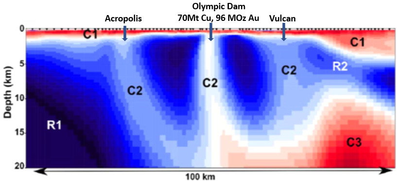
MT Section through Olympic Dam. Note the very large sub-horizontal conductor in the mid crust with near vertical conductors beneath known deposits. After Selway (2015)

This post is a summary and review of Murphy, B., Hjuizenga, J. and Bedrosian, P., 2022. Graphite as an electrically conductive indicator of ancient crustal-scale fluid flow within mineral systems. Earth and Planetary Science Letters. https://doi.org/10.1016/j.epsl.2022.117700

Summary

  • Magnetotelluric (MT) imaging has shown an apparent connection between crustal-scale electrical conductivity anomalies and major magmatic-hydrothermal iron oxide-apatite/iron oxide-copper-gold (IOA-IOCG) deposits in Australia and the United States
  • The exact cause of these anomalies has been unclear
  • Murphy et al (2022), interpret the conductors to be the result of graphite precipitation from CO2-rich magmatic fluids during cooling
  • These fluids exsolved from mafic magmas at mid- to lower-crustal depths
  • Saline magmatic fluids that could drive mineralization were likely derived from more evolved intrusions at shallower crustal levels
  • The conductivity anomalies mark zones that once were the deep roots of ancient magmatic-hydrothermal mineral systems
Continue reading Unravelling the Mystery of Graphite-Rich Magmatic-Hydrothermal Mineral Systems: MT Imaging Results from Australia and the US

Is this an Analogue for the Massive Mt Isa Cu-Pb-Ag Deposit

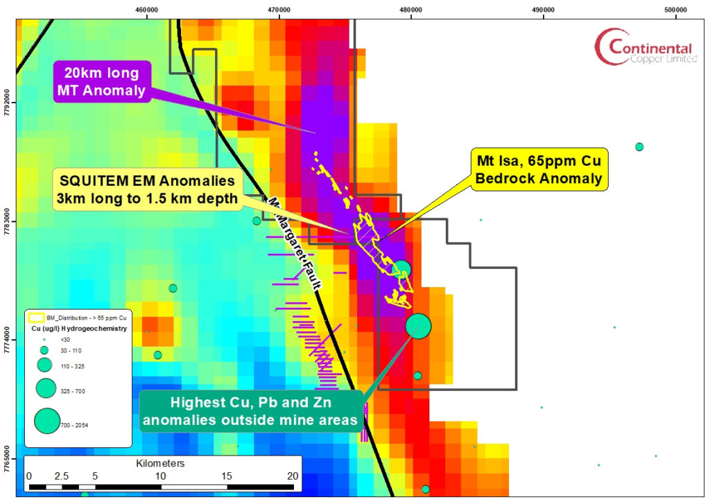
The Mt Isa bedrock copper anomaly (>65ppm) plotted over the 20km long magnetotelluric anomaly at 1,000 metres (Simpson, J. and Brown, D., 2023). Note the coincident large SQUITEM-EM Anomalies and hydrogeochemistry copper anomalies

The purpose of this post is to delineate the key characteristics of the Mt Isa deposit from an explorer’s pragmatic perspective and then discuss a possible analogue in the Eastern Succession, north of Cloncurry. Beside the fascinating tectonic, geological and structural history of the Mt Isa region,  it represents the largest repository of Pb-Zn metal.

Continue reading Is this an Analogue for the Massive Mt Isa Cu-Pb-Ag Deposit

The Geophysical Signature of Mt Isa Cu, Zn-Pb-Ag Ore Bodies

At a regional scale the Mt Isa Cu and Zn-Pb-Ag deposits do not have a noticeable gravity or magnetic response. In addition there is little recent literature on the geophysical signature of the deposits and the data which is available is dated.  Fallon and Busuttil 1992 and Valenta 2020 provide summaries of the available geophysical data. Given that pyrite extends up to 10 km north of economic grade mineralization within the Urquhart Shale and across a width of >1km, pristine mineralization would have  strong IP, EM and MT responses however this data is not readily available.

Continue reading The Geophysical Signature of Mt Isa Cu, Zn-Pb-Ag Ore Bodies

The Eastern Creek Volcanics: Source for the 8 Mt Copper Deposits at Mt Isa

Discovery of the Mt Isa Copper Deposits

Silver-lead ore was discovered at Mt Isa in 1923 but it was not until 1927 that a surface drill hole aimed to test silver-lead bodies at depth intersected 15 m of oxide copper and chalcocite grading 17% copper in the Black Rock area. This secondary mineralization was explored underground in 1937, mined intermittently for flux between 1941 and 1962, and by open cut from 1957.  Combined oxide and chalcocite ore mined from the Black Rock open cut between 1963 and 1967 totaled 2.26 Mt at an average grade of 3.9% copper.  It was not until 1930  while drilling lead-silver mineralization at depth that primary chalcopyrite mineralization was encountered reporting a best result of 8.8m at 8.5% Cu. Follow-up drilling in 1953 reported 17m at 2.0% Cu and in 1954 a most respectable 202m at 2.2% Cu (Perkins, 1999). 

Deposit Geology

The copper mineralization is hosted entirely within a broad zone of intense silica-dolomite alteration developed above the Paroo Fault within the Urquhart Shale (~1650-1955MA).   Economic copper ore bodies extend across a combined width of more than 1,000 metres and along a strike of 4,200 metres and entirely within the Urquhart Shale.

Continue reading The Eastern Creek Volcanics: Source for the 8 Mt Copper Deposits at Mt Isa

A Giant Cu-Pb-Zn Deposit Geochemical and Geophysical Signature

The Mount Isa Province in northern Australia is one of the world’s most prospective regions for minerals. It hosts three of the ten largest Zn–Pb deposits in the world, the world-class sediment- hosted Mount Isa copper deposit, and the Ernest Henry IOCG. 

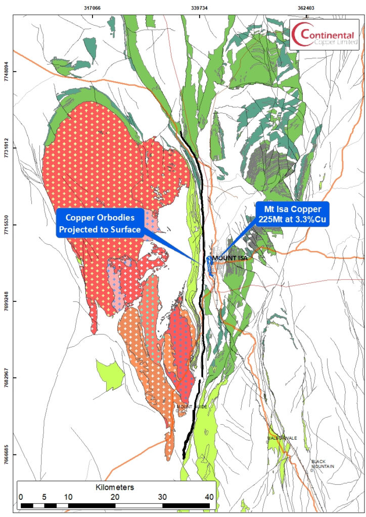
The Mount Isa copper (225 Mt at 3.3% Cu) and zinc-lead-silver ore (150 Mt at 7% Zn and 6% Pb) deposits are hosted within the Mesoproterozoic (1653 Ma) Urquhart Shale, an around 1000 m thick succession of carbonaceous, pyritic, dolomitic siltstone that belong to the Mt Isa Group, which lies within the Leichhardt River Fault Trough, and belongs to Calvert Superbasin in the Western Fold Belt of the Mt Isa Inlier.

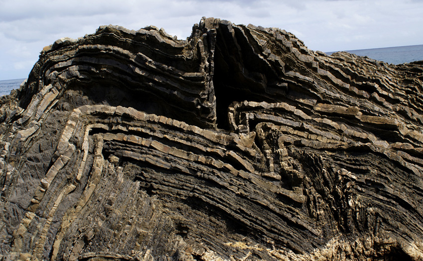
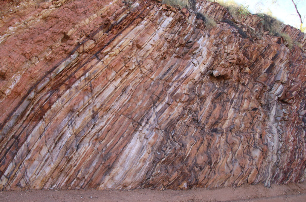
Urquhart Shale outcrop along Downs Road, Mt Isa (Courtesy Ian Withnall)
Continue reading A Giant Cu-Pb-Zn Deposit Geochemical and Geophysical Signature

A revised model for the George Fisher and Hilton Zn-Pb-Ag deposits, NW Queensland

This post is a review and summary of an excellent paper: Bradley Cave, Richard Lilly, Alexander Simpson, Lucy McGee, A revised model for the George Fisher and Hilton Zn-Pb-Ag deposits, NW Queensland: Insights from the geology, age and alteration of the local dolerite dykes, Ore Geology Reviews 154 (2023) 105311. https://doi.org/10.1016/j.oregeorev.2023.105311

SUMMARY

  1. The George Fisher and Hilton Zn-Pb-Ag deposits are located approximately 20 km north of Mount Isa.
  2. A dolerite dyke has been discovered at the George Fisher Zn-Pb-Ag deposit and the dolerite dyke have a large spike in TiO2 and V values.
  3. In drill core, the dolerite dykes occur as a light grey to grey-brown coloured rock that is commonly overprinted along its margins by Zn-Pb-Ag mineralisation.
  4. In-situ U-Pb geochronology performed on igneous apatite produce a lower intercept age of 1611 +/- 21 Ma and 1619 +/- 22 Ma for the dolerite dykes at the George Fisher and Hilton deposits, respectively.
  5. The dolerite dykes have experienced multiple stages of post-emplacement hydrothermal alteration/veining.
  6. Monazite from a quartz-albite-K-feldspar vein in the Hilton dyke produces a lower intercept age of 1513 +/- 16 Ma.
  7. To assess the timing of alteration in the adjacent George Fisher Zn-Pb-Ag deposit, in-situ Lu-Hf geochronology was performed on pre-mineralisation calcite from a section of stratabound Zn-Pb-Ag mineralisation, and a paragenetically late cross-cutting sphalerite-calcite vein.
  8. Calcite from the pre-mineralization alteration assemblage produces a Lu-Hf age of 1501 +/- 32 Ma.
  9. Calcite from a cross-cutting vein that post-dates Zn-Pb-Ag deposition produced a Lu-Hf age of 1289 +/- 26 Ma. The 1289 Ma age is associated with late faulting and movement along the adjacent Mount Isa Fault (B. Cave pers comms 2023).
  10. The paragenetic equivalents of the hydrothermal alteration/veining in the dolerite dykes are found in the adjacent Zn-Pb-Ag orebodies.
  11. The maximum age of alteration within the dolerite dykes is constrained by the monazite age of 1513 +/- 16 Ma, and the maximum age of stratabound Zn-Pb-Ag mineralisation is constrained by the Lu-Hf age of 1501 +/- 32 Ma.
  12. The dolerite dykes intruded during the early Isan Orogeny at ca. 1620 Ma, and experienced subsequent hydrothermal alteration during D3 of the Isan Orogeny coeval with Zn-Pb-Ag mineralization. Post mineralization faulting occurred during D2 of the Isan Orogeny, at ca. 1290 Ma.
Continue reading A revised model for the George Fisher and Hilton Zn-Pb-Ag deposits, NW Queensland