Category Archives: Geoscience

The Evolution of the High-Sulfidation Epithermal Cu-Au-Ag Recsk Deposit in Hungary

This paper in the latest edition of Economic Geology by Ágnes Takács,  Ferenc Molnár,  Judit Turi,  Aberra Mogessie,
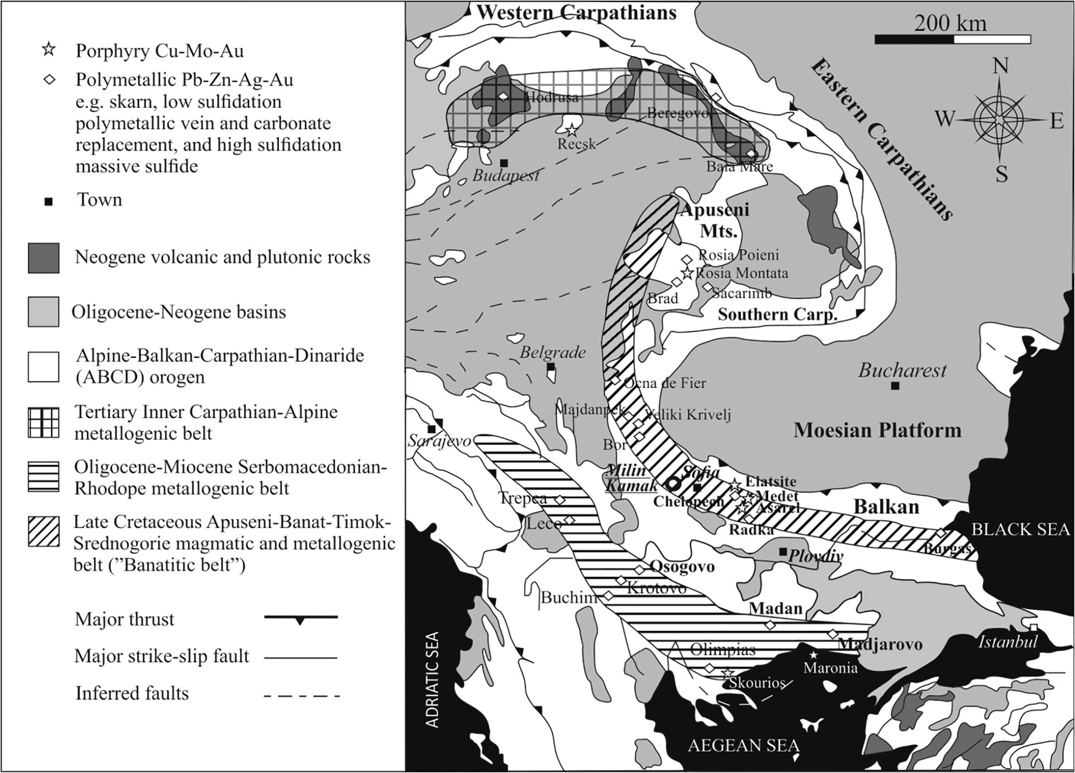
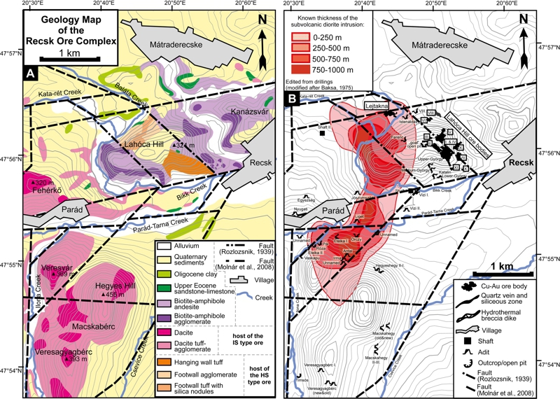
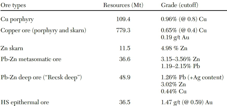
 John C. Menzies examines the evolution of the outcropping epithermal mineralisation at Recsk in Hungary.  The epithermal deposit sits close to the apex of a large intrusive body which does not outcrop but was defined by systematic diamond drilling to 1,200 metres over a 35km2 area.  While the outcropping HS epithermal mineralisation was sporadically mined, the unexposed porphyry and related skarns and replacement bodies was not exploited.  The deeper mineralisation has been evaluated with 156,000 metres of drilling from surface and 90,000 metres of diamond drilling from underground development on two levels accessible via two 1200 metre deep, 8 metre internal diameter concrete lined shafts.  There is considerable potential for the discovery of both additional mineralised bodies (this paper suggests an as yet undiscovered intrusive to the north of the known body) and extensive skarn mineralisation around the periphery of the intrusion.

HIGHLIGHTS

  • Largely uneroded porphyry-skarn-epithermal metallogenic system of Paleogene age in a subduction-related magmatic hydrothermal environment within the Alpine-Carpathian region
  • Paleogene diorite intrusions and Mesozoic carbonate and silicic shale host rocks contain Cu(-Mo-Au)-porphyry, Cu-Zn(-Fe) skarn, and metasomatic Pb-Zn (carbonate replacement) mineralization from ~400- to at least 1,200-m depth below the surface.
  • Three stages of ore formation
  • Stage 1:  Ore deposition in the porphyry-epithermal transition zone (pyrite, chalcopyrite, tennantite-tetrahedrite, galena, sphalerite; 260°–230°C; logfs2~–11 to –9; logfTe2~ –19 to –14)
  • Stage 2: High- and very high sulfidation state mineralization from tellurium-saturated fluids (e.g., enargite, luzonite, pyrite, native gold, calaverite, hessite, aikinite-bismuthinite; 240°–170°C; logfS2~–7 to –11; logfTe2~–14.8 to –10.5)
  • Stage 3: Late-stage mineralization from tellurium-oversaturated, locally oxidized fluids of an intermediate-sulfidation state (e.g., tennantite-goldfieldite, pyrite, hessite, petzite, native tellurium, kawa-zulite; logfs2~–11 to –15.5; logfTe2 ≥ –10.5)
Geology and mineralization of the Recsk ore complex. (A) Combined geological and topographical map of the studied area. The geology is modified after Pantó (1952) and the tectonics are modified after Rozlozsnik (1939) and Molnár et al. (2008). (B) Topographical map with contoured thickness of the subvolcanic diorite intrusion, mineralized bodies, and historical adits. The locations of high-sulfidation epithermal orebodies are based on the map from Földessy et al. (2008a), and the thicknesses of diorite intrusive stocks intercepted in the 1,200-m-deep drill holes completed in the area are from Baksa (1975). Abbreviations: HS = high-sulfidation, IS = intermediate-sulfidation.
Estimated Ore Resources for the Recsk Ore Complex (data from Fodor et al., 1998; Kontsek et al., 2006)

ABSTRACT

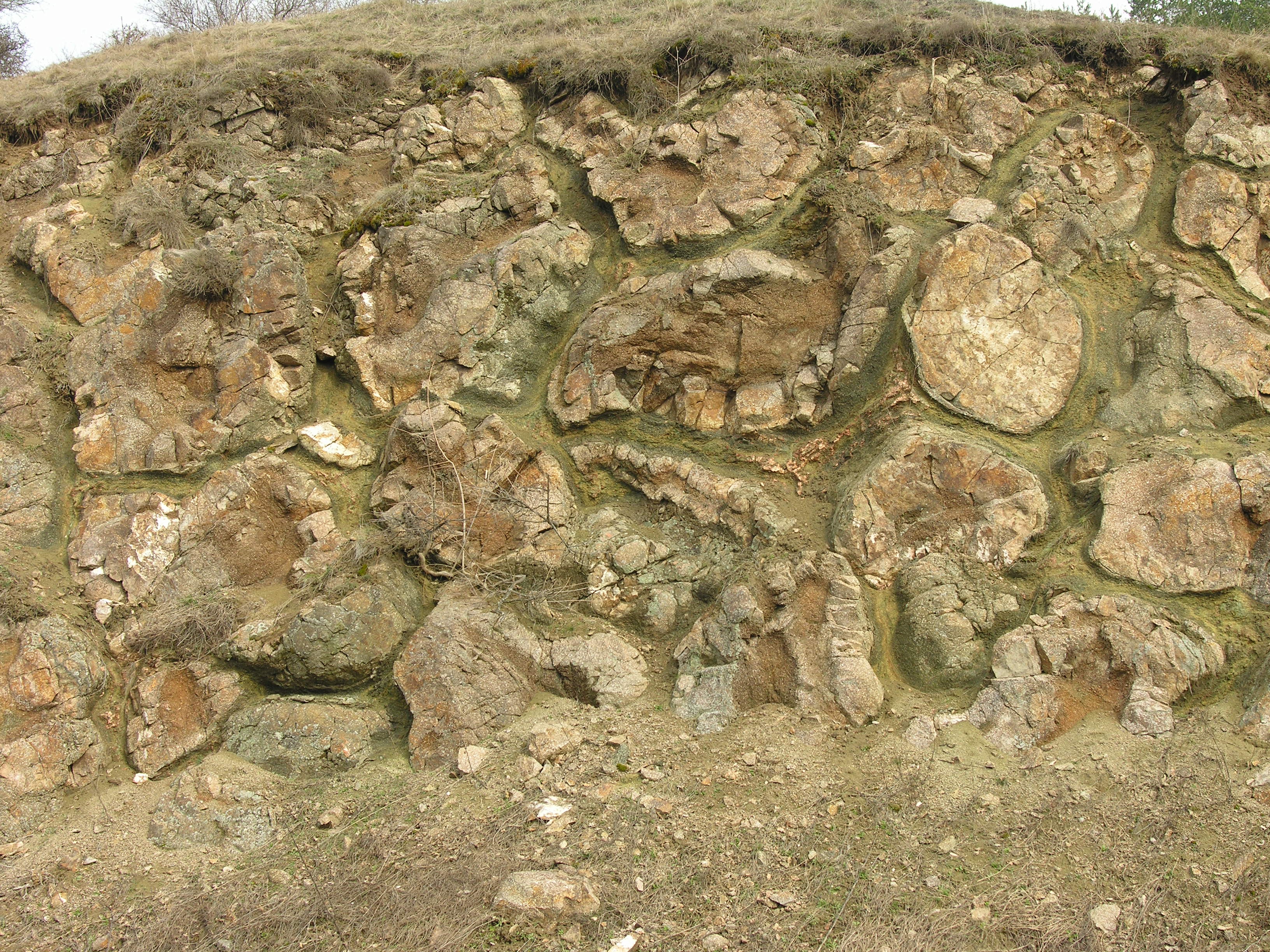
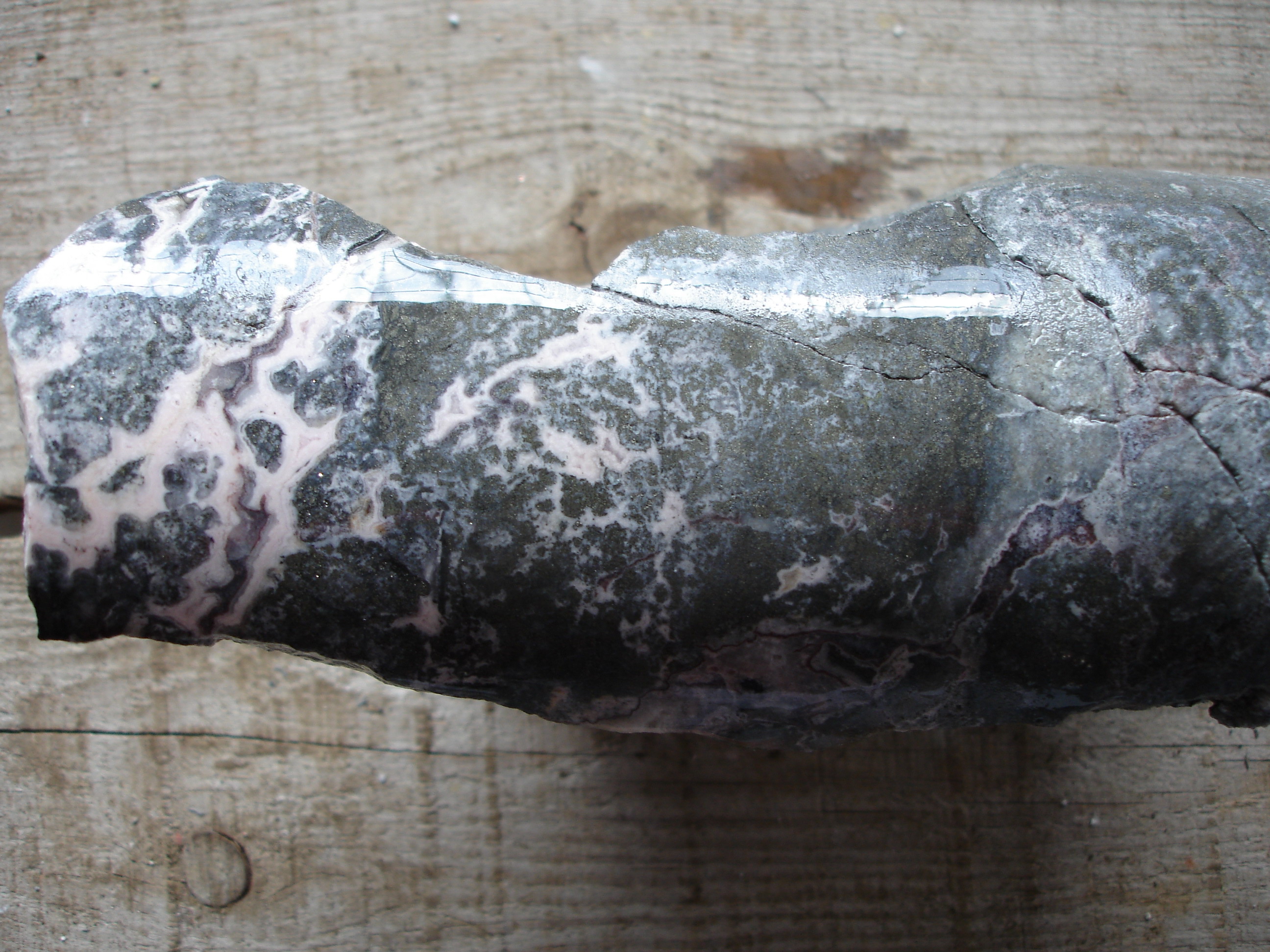
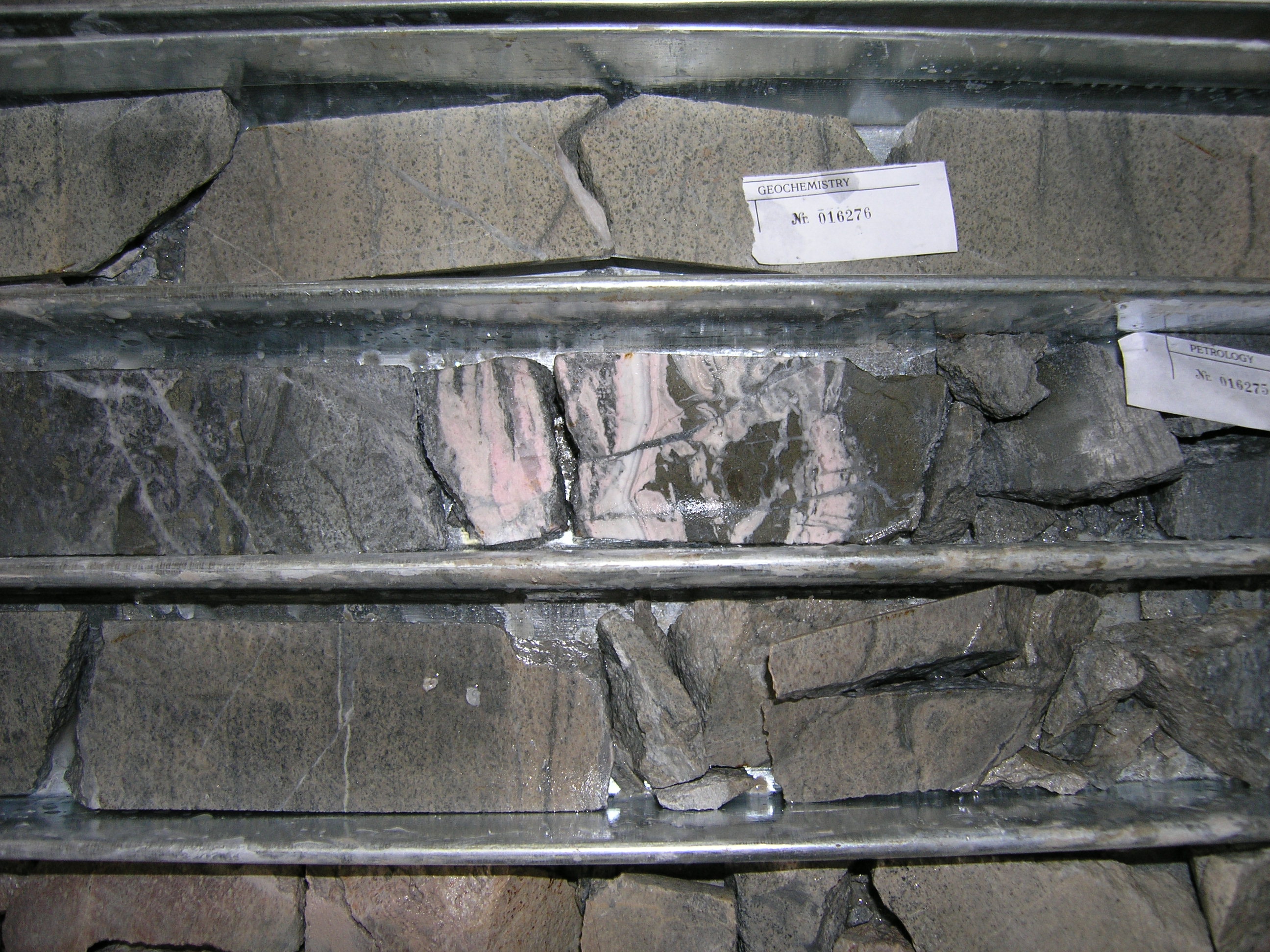
The Recsk ore complex is an example of a largely uneroded porphyry-skarn-epithermal metallogenic system in a subduction-related magmatic hydrothermal environment within the Alpine-Carpathian region. Paleogene diorite intrusions and Mesozoic carbonate and silicic shale host rocks contain Cu(-Mo-Au)-porphyry, Cu-Zn(-Fe) skarn, and metasomatic Pb-Zn (carbonate replacement) mineralization from ~400- to at least 1,200-m depth below the surface. The Mesozoic sedimentary rocks are unconformably overlain by a stratovolcanic sequence of andesitic to dacitic composition that hosts epithermal Cu-Au-Ag and Au-Ag-Pb-Zn mineralization. This study focuses on the shallow high-sulfidation epithermal Cu-Au-Ag mineralization exposed and exploited on Lahóca Hill. The ore mineralogy combined with the microthermometry of quartz- and enargite-hosted fluid inclusions suggest three stages of the ore formation: (1) early-stage ore deposition in the porphyry-epithermal transition zone (pyrite, chalcopyrite, tennantite-tetrahedrite, galena, sphalerite; 260°–230°C; logfs2~–11 to –9; logfTe2~ –19 to –14); (2) high- and very high sulfidation state mineralization from tellurium-saturated fluids (e.g., enargite, luzonite, pyrite, native gold, calaverite, hessite, aikinite-bismuthinite; 240°–170°C; logfS2~–7 to –11; logfTe2~–14.8 to –10.5); and (3) late-stage mineralization from tellurium-oversaturated, locally oxidized fluids of an intermediate-sulfidation state (e.g., tennantite-goldfieldite, pyrite, hessite, petzite, native tellurium, kawa-zulite; logfs2~–11 to –15.5; logfTe2 ≥ –10.5). The observed differences in ore mineral assemblages and trace element compositions of sulfides reflect the temporal and spatial evolution of the ore-forming hydrothermal system. Results of fluid inclusion microthermometry performed by conventional and infrared-light microscopy and Raman spectroscopic studies support a model with lateral flow of shallow hydrothermal fluids. The spatial distribution of paleotemperature data within the high-sulfidation portion of the ore deposit suggests that the fluid flow system is offset from the closest apex of the related mineralized porphyry stock. This could be due to structural complexity related to syn- to postmineralization tectonism and/or due to the presence of an undiscovered intrusion to the north of the known mineralized stock.

Original Research here

Ore minerals and textures of the Lejtakna high-sulfidation epithermal mineralization. (A) Stage 1 assemblage sphalerite within enargite. (B) Intergrowth of stage 2 enargite and luzonite (crossed polars). (C) Resorbed textured and partially replaced enargite crystal fragments in a tennantite-tetrahedrite matrix. (D) Stage 3 assemblage from the central part of the Lejtakna deposit with textures not observed at Lahóca Hill. (E) Framboidal pyrite cemented by galena. (F) Collomorphic pyrite-chalcopyrite assemblage with tennantite-tetrahedrite and sphalerite. (G) Collomorphic pyrite-chalcopyrite-galena assemblage in barite. (H) Intergrowth of pyrite and galena crystals. (I) Planar and cross-laminated layers consisting of pyrite and quartz. Note: Samples E through I are from the shallowest parts of the Lejtanka deposit.

Milin Kamak intermediate sulfidation epithermal Au-Ag deposit in Western Srednogorie, Bulgaria

Here is a brief paper, by Ralica Sabeva Vassilka Mladenova and Aberra Mogessie on the gold deposits around the small western Bulgarian town of Breznik.  I acquired this project for Euromax Resources Limited back in 2003 and we explored this until my departure in 2010.  A rather nice intermediate sulphidation gold deposit which has now had the necessary fluid inclusion and sulphur isotope work conducted by Bulgarian and Austrian researchers.

Stay current on Geoscience research subscribe to Cmi Geoscience

John C. Menzies and Greg Hall at Breznik in beautiful western Bulgaria

Our intention while I was CEO was to devleop this deposit using adits and an internal winze.  .

Pillow Lavas of Late Cretaceous Age, west of the town of Breznik, Bulgaria

Highlights

  • Situated in the Late Cretaceous 80-100km wide Apuseni-Banat-Timok-Srednogorie (ABTS) magmatic and metallogenic belt;
  • The deposit is hosted by altered trachybasalt to andesitic trachybasalt volcanic and volcanoclastic rocks;
  • 2.4 Mt at 5.91 g/t Au and of 26.78 g/t Ag, the probable reserves and resources are 13.1 tonnes of gold and 59.5 tonnes of silver;
  • Strike of 400-1000 metres and widths of cms up to 15 metres;
  • Temperature of formation ~238 to 273°C, salinity of 3.7-6.6% and  δ34S average of 1.350/00 suggestive of a magmatic sulphur source;
  • Fluid evolution from a low sulphidation through later intermediate (precious metals) stage.
Simplified geological map of Western Srednogorie zone in Bulgaria with the main paleovolcanic centres (after Dabovski et al. (2009) modified by Velev et al. (2012)). (B) Simplified geological map of Milin Kamak area.

Abstract

The Milin Kamak gold-silver deposit is located in Western Srednogorie zone, 50 km west of Sofia, Bulgaria. This zone belongs to the Late Cretaceous Apuseni-Banat-Timok-Srednogorie magmatic and metallogenic belt. The deposit is hosted by altered trachybasalt to andesitic trachybasalt volcanic and volcanoclastic rocks with Upper Cretaceous age, which are considered to be products of the Breznik paleovolcano. Milin Kamak is the first gold-silver intermediate sulfidation type epithermal deposit recognized in Srednogorie zone in Bulgaria. It consists of eight ore zones with lengths ranging from 400 to 1000 m, widths from several cm to 3–4 m, rarely to 10–15 m, an average of 80–90 m depth (a maximum of 200 m) and dip steeply to the south. The average content of gold is 5.04 g/t and silver – 13.01 g/t. The styles of alteration are propylitic, sericite, argillic, and advanced argillic. Ore mineralization consists of three stages. Quartz-pyrite stage I is dominated by quartz, euhedral to subhedral pyrite, trace pyrrhotite and hematite in the upper levels of the deposit. Quartz-polymetallic stage II is represented by major anhedral pyrite, galena, Fe-poor sphalerite; minor chalcopyrite, tennantite, bournonite, tellurides and electrum; and trace pyrrhotite, arsenopyrite, marcasite. Gangue minerals are quartz and carbonates. The carbonate-gold stage III is defined by deposition of carbonate minerals and barite with native gold and stibnite.

Fluid inclusions in quartz are liquid H2O-rich with homogenization temperature (Th) ranging from 238 to 345 °C as the majority of the measurements are in the range 238–273 °C. Ice-melting temperatures (Tm) range from −2.2 to −4.1 °C, salinity – from 3.7 to 6.6 wt.% NaCl equiv. These measurements imply an epithermal environment and low- to moderate salinity of the ore-forming fluids.

δ34S values of pyrite range from −0.49 to +2.44‰. The average calculated δ34S values are 1.35‰. The total range of δ34S values for pyrite are close to zero suggesting a magmatic source for the sulfur.

Read the Full Text Here

Late stage intermediate sulphidation mineralization at Breznik.
Quartz-pyrite stage I is dominated by quartz, euhedral to subhedral pyrite, trace pyrrhotite and hematite in the upper levels of the deposit. Quartz-polymetallic stage II is represented by major anhedral pyrite, galena, Fe-poor sphalerite; minor chalcopyrite, tennantite, bournonite, tellurides and electrum; and trace pyrrhotite, arsenopyrite, marcasite. Gangue minerals are quartz and carbonates. The carbonate-gold stage III is defined by deposition of carbonate minerals and barite with native gold and stibnite.

Breznik a Centre of Local Culture & Spectacular Kukeri Festival

Breznik is a delightful small town in western Bulgaria and well worth a visit.

In the middle of winter across the Balkans, Kukeri festivals allow for mid-winter celebrations.

Kukeri are elaborately costumed Bulgarian men (and some wonen) who perform traditional rituals intended to scare away evil spirits. Closely related traditions are found throughout the Balkans and Greece (including Romania and the Pontus). The costumes cover most of the body and include decorated wooden masks of animals (sometimes double-faced) and large bells attached to the belt. Around New Year and before Lent, the kukeri walk and dance through villages to scare away evil spirits with their costumes and the sound of their bells. They are also believed to provide a good harvest, health, and happiness to the village during the year. The custom is generally thought to be related to the Thracian Dionysos cult in the wider area of Thracia. (after Wikipedia)

Melting sea ice could help cool the planet by flooding the atmosphere with particles that deflect sunlight.

Immense quantities of reflective compounds, emitted by marine microbes, act like a handbrake on global warming.

Italicized text from:  The Australian, August 24, 2017

Australian research suggests climate modellers have under­estimated a natural “thermostat” that helps alleviate the rise in temperatures: immense quantities of reflective compounds, emitted by marine microbes, that act like a handbrake on global warming.

The study, published by the American Meteorological Society, suggests an overlooked source of these so-called aerosols — algae living in ice — could jam the handbrake on even harder. Lead author Albert Gabric said with the Arctic expected to see ice-free summers within a decade, far more of the aerosols would be emitted.

We examine the relationship between sea ice dynamics, phytoplankton biomass and emissions of marine biogenic aerosols in both Arctic and Southern Oceans.

Accurate estimation of the climate sensitivity requires a better understanding of the nexus between polar marine ecosystem responses to warming, changes in sea ice extent and emissions of marine biogenic aerosol (MBA). Sea ice brine channels contain very high concentrations of MBA precursors that once ventilated have the potential to alter cloud microphysical properties, such as cloud droplet number, and the regional radiative energy balance. In contrast to temperate latitudes, where the pelagic phytoplankton are major sources of MBAs, the seasonal sea ice dynamic plays a key role in determining MBA concentration in both the Arctic and Antarctic. We review the current knowledge of MBA sources and the link between ice melt and emissions of aerosol precursors in the polar oceans. We illustrate the processes by examining decadal scale time series in various satellite-derived parameters such as aerosol optical depth (AOD), sea ice extent and phytoplankton biomass in the sea ice zones of both hemispheres. The sharpest gradients in aerosol indicators occur during the spring period of ice melt. In sea ice covered waters, the peak in AOD occurs well before the annual maximum in biomass in both hemispheres. The results provide strong evidence that suggests seasonal changes in sea ice and ocean biology are key drivers of the polar aerosol cycle. The positive trend in annual mean Antarctic sea ice extent is now almost one-third of the magnitude of the annual mean decrease in Arctic sea ice, suggesting the potential for different patterns of aerosol emissions in the future.

 
“Whether that can slow the rate of warming of the Arctic is the trillion-dollar question,” said Dr Gabric, a marine biogeo­chemist with Griffith University in Brisbane.
 
Climate scientists have long known that aerosols help mitigate global warming by bouncing sunrays back into space, and by altering clouds to make them more reflective. Experts believe half of the ­potential warming from greenhouse gases may be offset in this way.
 
Much research has focused on aerosols produced artificially, through the burning of fossil fuels and vegetation. Scientists worry that if China switched to renewable sources of energy overnight, it could trigger a massive surge in warming.
 
Aerosols are also produced naturally by volcanoes — such as the 1991 eruption of Mount Pinatubo in The Philippines, which is credited with cutting global temperatures by about 0.5C for two years — and by marine ecosystems.
 
Algae known as “phytoplankton” are a major contributor, with increasingly massive blooms of these marine creatures emerging in the warming Arctic waters.
The new study analysed terabytes of satellite data to track atmos­pheric aerosol concen­trations. For the first time, it identified sea ice as a “very strong source” of the airborne particles.
 
Dr Gabric said “ice algae” had evolved to tolerate the subzero temperatures of sea ice and the water that formed it. They used a compound called dimethyl sulfide as an “antifreeze” to survive the chill. “When the sea ice melts during spring, these algae don’t need that protection any more. They expel these compounds, which are degassed to the atmosphere and converted into sulfate aerosols very similar to what you get from burning sulphur-containing coal.
 
“This happens every year as the sea ice melts. The difference in recent decades is that the ice is melting a lot earlier. We now think that within 10 years there won’t be any ice in the Arctic during summer.”
 
He said the process had “absolutely not” been factored into the Intergovernmental Panel on Climate Change models of global warming. “The whole aerosol question and its relationship to warming is the biggest uncertainty to projecting what’s going to happen this century.
 
“This is a new area of ­research, primarily because people can’t get up there and measure it very easily. You need an ice­breaker and a big gun to shoot any polar bears that might want to eat you,” he said. 

The Palaeozoic Variscan Oceans. An outstanding geoscience research contribution


The Variscan area of Europe with palinspastic movement of Iberia in relation to Central Europe to take account of the Bay of Biscay opening. Franke et al 2017

Gondwana Research 48 (2017) 257–284: Read Here
Wolfgang Franke, L. Robin M. Cocks, Trond H. Torsvik

The Variscan and related North American orogenies which now total 6,000 kilometres of strike, were caused by the opening and closing of the Rheic Ocean over a 100 million year period from 440MA to 320MA. This period saw the creation of several minor oceans and seaways, repeated periods of rifting and subduction and ultimately with the amalgamation of Laurussia and Gondwana, formation of the Pangea super-continent. Wolfgang Franks and colleagues have undertaken a comprehensive review and re-interpretation of the oceanic history of the Variscan domain. They attribute the complex geology to the opening and closing of 5 oceans or seaways, rifting and repeated subduction events. As a consequence of this complex tectonism, Variscan Europe is well endowed with mineral deposits although few are in production. Indeed this is where the industrial exploitation of Cu, Pb, Zn, Ag and Au commenced in post Roman times. The proposed complexity is very similar to that observed along the margins of the Tethyan Ocean to the east during a later period. This paper is well worth a detailed review.

In the comments below we summarize the Franks et al paper to produce a history of the Variscan.

A Brief History of the Variscan

Early Palaeozoic

  • From at least Cambrian times the Armorican Terrane Assemblage (ATA) appears to have formed a promontory at the edge of the Gondwana Craton near NW Africa
  • In the early Ordovician (~490MA) along the eastern side of Iapetus Ocean a rift developed along the NW flank of Gondwana forming the Rheic Ocean. A rifted Gondwana fragment Avalonia moved westwards towards Laurussia as the Rheic Ocean expanded at the expense of the Iapetus;
  • The Rheic Ocean became very wide;
  • Towards the end of the Ordovician Avalonia merged with Laurussia with much strike-slip faulting;

Silurian

  • During the Late Silurian and Early Devonian NE subduction of the Rheic Ocean lead to back-arc spreading and sedimentation in what is now in part the Rheno-Hercynian belt
  • Additional rifting in the Silurian (~440MA) along the NW margin of Africa resulted in the formation of the Saxo-Thuringian and the Galicia-Moldanubian seaways and the separation of the ATA elements from each other and ATA from Gondwana (with Palaeo-Adria to the immediate east).

Devonian

  • The Saxo-Thuringian Ocean and ultimately, collision of the Thuringia and Franconia elements of the ATA with Avalonia previously accreted onto Laurussia (Baltica) occurred at ~ 400MA with the final closure of the NW extent of the Rheic Ocean;
  • During the Devonian there was widespread strike-slip movement between ATA and Palaeo-Adria to the east possibly as consequence of east verging oblique subduction of the Saxo-Thuringian Ocean;
  • In the Early Emsian, the Rheic mid-ocean ridge was subducted southwards under the northernmost part of the ATA (Franconia), creat­ing the short-lived Baja California-type Rheno-Hercynian Ocean which incorporated the former back-arc basin sediments
  • The northward and lateral movements of Gondwana saw the successive closure of the Galicia-Moldanubian, Saxo-Thuringian and Rheic Oceans from south to north, over the period from about 380Ma through the Early carboniferous

Carboniferous and Permian

  • Laurussia and Gondwana finally collided at around 320MA to form the super-continent Pangea
  • Prior to this collision there was significant dextral strike-slip movement between Laurussia and Gondwana
  • Post collision, the Amorican terranes returned to roughly the same location prior to their separation more than 100 million years earlier;
  • This collision produced a very extensive orogen extending from the Ouachita and the Alleghanian Orogenies in North America through the Variscan of Western Europe;
  • Continued shortening into the Late Carboniferous saw dextral strike-slip faulting along the SW margin of Baltica and clockwise rotation of the Bohemian Arc into its current location
  • This orogenesis extended from the Carboniferous into the Middle Permian with collisional shortening of more than 1,000 km.

Abstract

Geological evidence, supported by biogeographical data and in accord with palaeomagnetic constraints, indicates that “one ocean” models for the Variscides should be discarded, and confirms, instead, the existence of three Gondwana-derived microcontinents which were involved in the Variscan collision: Avalonia, North Armorica (Franconia and Thuringia subdivided by a failed Vesser Rift), and South Armorica (Central Iberia/Armorica/ Bohemia), all divided by small oceans. In addition, parts of south-eastern Europe, including Adria and Apulia, are combined here under the new name of Palaeo-Adria, which was also Peri-Gondwanan in the Early Palaeozoic. Oceanic separations were formed by the break-up of the northern Gondwana margin from the Late Cambrian onwards. Most of the oceans or seaways remained narrow, but – much like the Alpine Cenozoic oceans – gave birth to orogenic belts with HP-UHP metamorphism and extensive allochthons: the Saxo-Thuringian Ocean be­tween North and South Armorica and the Galicia-Moldanubian Ocean between South Armorica and Palaeo-Adria. Only the Rheic Ocean between Avalonia and peri-Gondwana was wide enough to be unambiguously recorded by biogeography and palaeomagnetism, and its north-western arm closed before or during the Emsian in Europe. Ridge subduction under the northernmost part of Armorica in the Emsian created the narrow and short-lived Rheno-Hercynian Ocean. It is that ocean (and not the Rheic) whose opening and closure controlled the evolution of the Rheno-Hercynian fold-belt in south-west Iberia, south-west England, Germany, and Moravia (Czech Republic). Devonian magmatism and sedimentation set within belts of Early Variscan deformation and metamor­phism are probably strike-slip-related. The first arrival of flysch on the forelands and/or the age of deformation of foreland sequences constrains the sequential closure of the Variscan seaways (Galicia-Moldanubian in the Givetian; Saxo-Thuringian in the Early Famennian; Rheno-Hercynian in the Tournaisian). Additional Mid- to Late Devonian and (partly) Early Carboniferous magmatism and extension in the Rheno-Hercynian, Saxo-Thuringian and Galicia-Moldanubian basins overlapped with Variscan geodynamics as strictly defined. The Early Carboniferous episode was the start of episodic anorogenic heating which lasted until the Permian and probably relates to Tethys rifting.

Gondwana Research 48 (2017) 257–284: Read Here

A Planet of Plates

Chris Harrison from Department of Marine Geosciences, Rosenstiel School of Marine and Atmospheric Science, University of Miami  in a paper in Earth,  Planets and Space has sought to resolve the question of the number plates that make up the surface of the earth.

Major Plate Boundaries. By USGS – http://pubs.usgs.gov/publications/text/slabs.html, Public Domain, https://commons.wikimedia.org/w/index.php?curid=535201

The number of tectonic plates on Earth described in the literature has expanded greatly since the start of the plate tectonic era, when only about a dozen plates were considered in global models of present-day plate motions.  With an ever-increasing number of earthquake monitoring sites, improving  ocean bathymetry using swath mapping, and the use of space based geodetic techniques, there has been a huge growth in the number of plates thought to exist.  In 2003 the total was thought to be 52 delineated on the basis of earthquake epicentre data.

Chris now proposes a total of 159 plates (with some additional smaller plates yet to be mapped).

The largest plate (Pacific) is about 20 % of the Earth’s area or 104 million km2, and the smallest plate is only 273 km2. The Earth is continuously evolving with the continuous creation of new oceanic crust and its destruction in subduction zones.  This has a very significant impact on the distribution of continents, movement of water within the worlds oceans (over time) and plays an important part in the evolution of life on this planet.

REF: The present-day number of tectonic plates, Earth, Planets and Space 2016, 68:37.  Download PDF

Abstract

The number of tectonic plates on Earth described in the literature has expanded greatly since the start of the plate tectonic era, when only about a dozen plates were considered in global models of present-day plate motions. With new techniques of more accurate earthquake epicenter locations, modern ways of measuring ocean bathymetry using swath mapping, and the use of space based geodetic techniques, there has been a huge growth in the number of plates thought to exist. The study by Bird (2003) proposed 52 plates, many of which were delineated on the basis of earthquake locations. Because of the pattern of areas of these plates, he suggested that there should be more small plates than he could identify. In this paper, I gather together publications that have proposed a total of 107 new plates, giving 159 plates in all. The largest plate (Pacific) is about 20 % of the Earth’s area or 104 Mm2, and the smallest of which (Plate number 5 from Hammond et al. 2011) is only 273 km2 in area. Sorting the plates by size allows us to investigate how size varies as a function of order. There are several changes of slope in the plots of plate number organized by size against plate size order which are discussed. The sizes of the largest seven plates is constrained by the area of the Earth. A middle set of 73 plates down to an area of 97,563 km2 (the Danakil plate at number 80, is the plate of median size) follows a fairly regular pattern of plate size as a function of plate number. For smaller plates, there is a break in the slope of the plate size/plate number plot and the next 32 plates follow a pattern of plate size proposed by the models of Koehn et al. (2008) down to an area of 11,638 km2(West Mojave plate # 112). Smaller plates do not follow any regular pattern of area as a function of plate number, probably because we have not sampled enough of these very small plates to reveal any clear pattern.