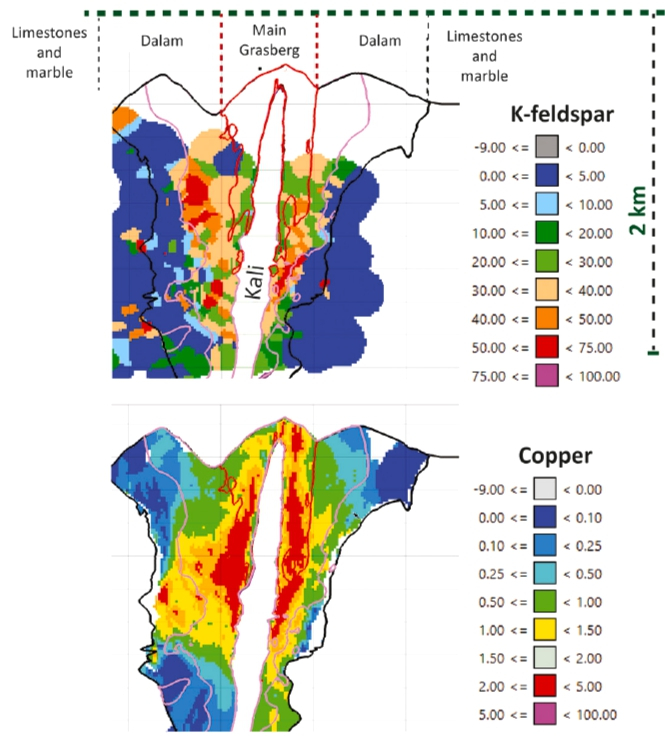
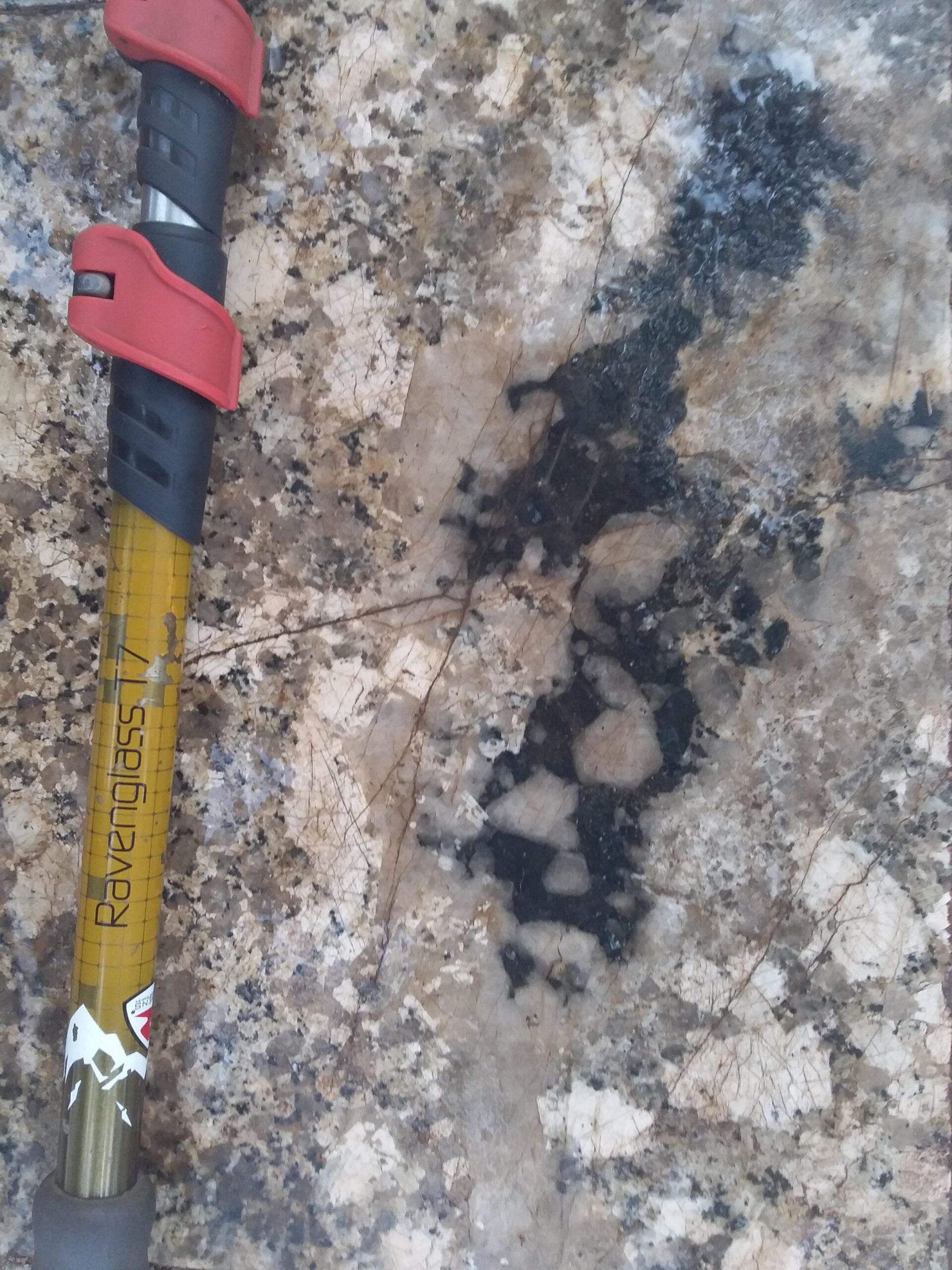
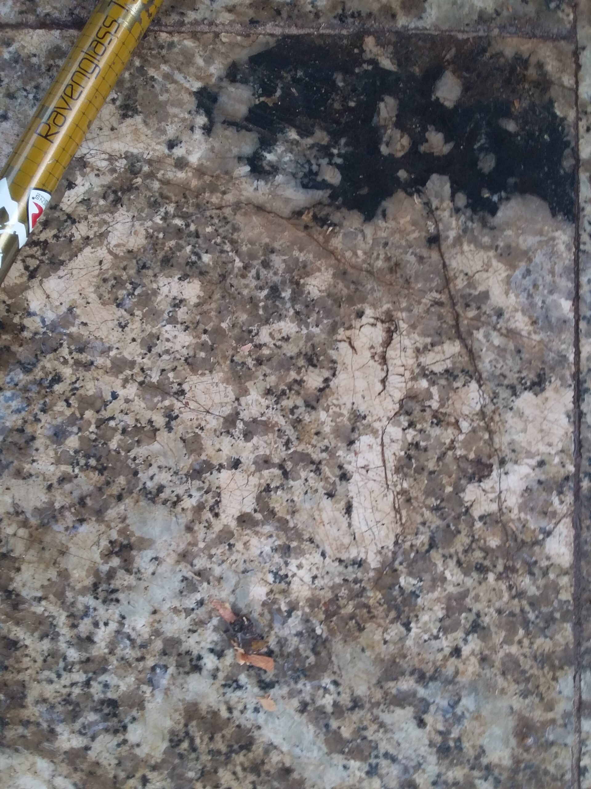
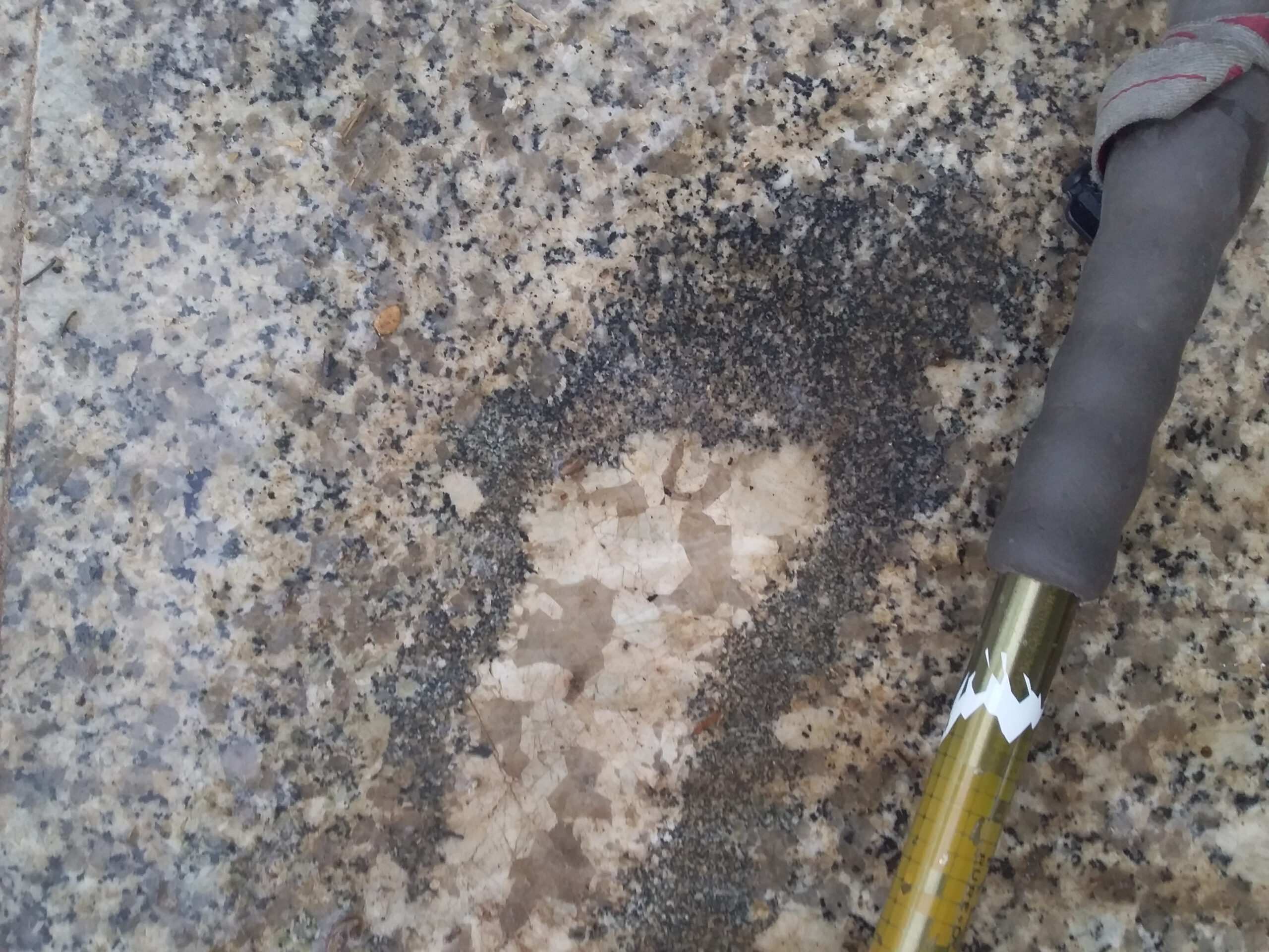
Hereis an excellent paper from Richard Henley et al that provides support for the argument that potassic alteration is largely isochemcial and and not an introduced component. Henley has elequently definedthe porphyry copper environment as that of a dynamic, internally and externally stressed, gas phase reactor where repetitive fracturing generates high permeability flow paths for expansion of the magmatic gas phase from source to surface.
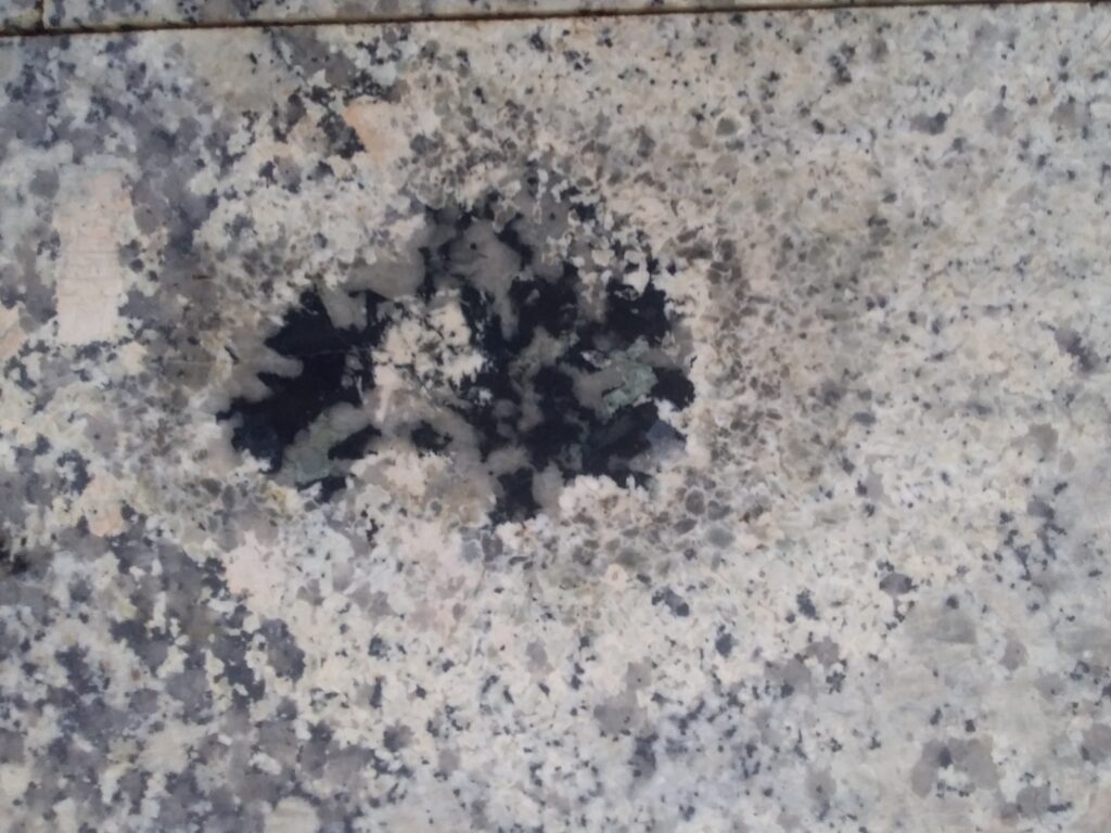
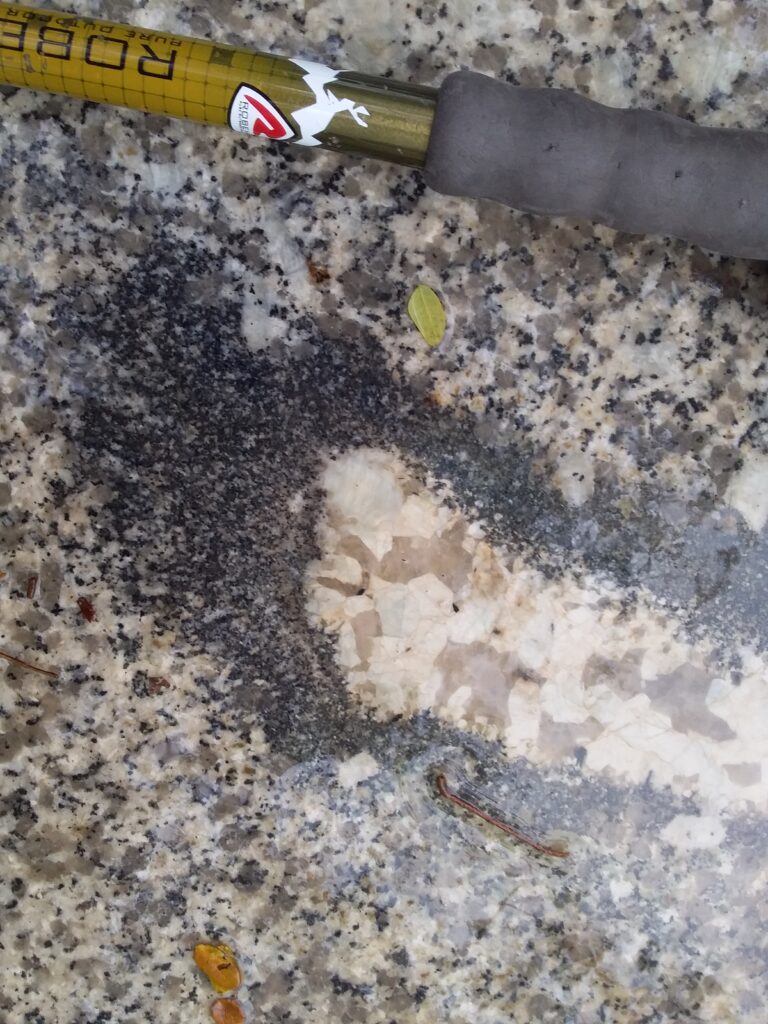
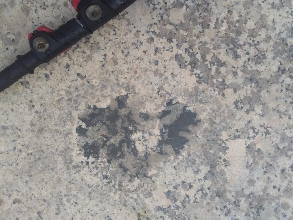
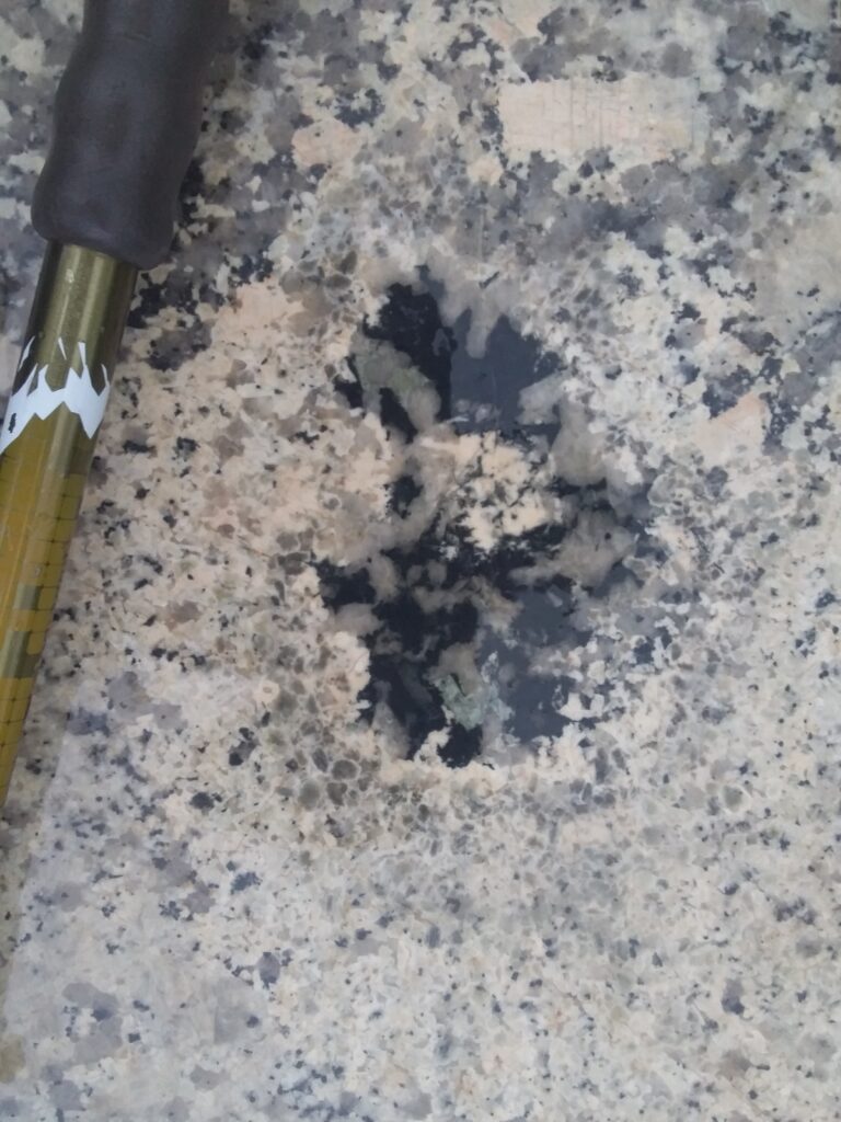
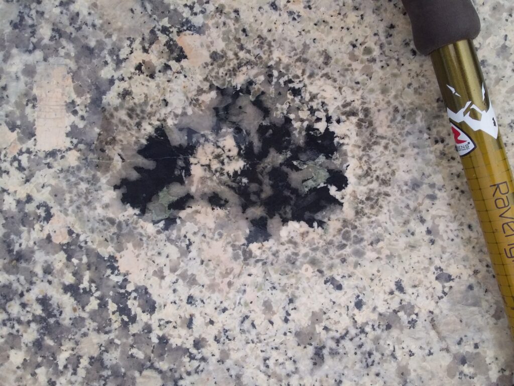
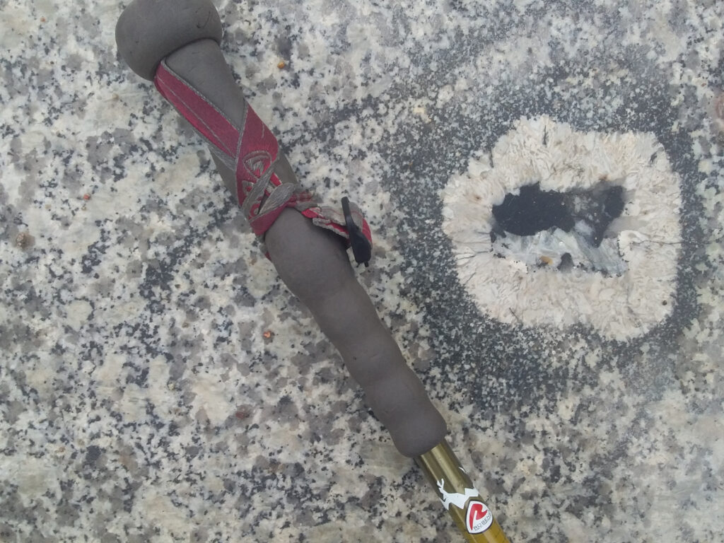
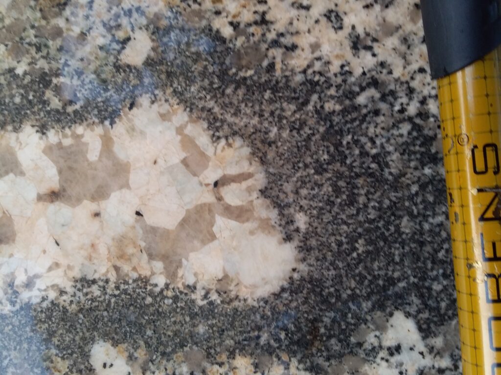
Siem Reap has 98km of new roads and new sidewalks much of which has been paved with interesting felsic intrusive rocks from quarries in Shandong Province in China. The composition ranges from granodiorite to tonalite and is locally granophyric and pegmatitic. The intrusive consists dominantly of plagioclase, quartz, pyroxene and hornblende. Ovoid structures known as Miarolitic Cavities are evident in the sidewalks to the observant and indicates that the parental magma was hydrous. While no cavities have been observed in the sidewalks of Siem Reap it is quite possible that miarolitic cavities which retained cavities were not processed into saleable dimension stone. When the location of the quarry in Shandon Province is identified maybe a field trip is warranted.
The term miarolitic comes from the Italian miarole in reference to the mineral-rich pegmatite region of Baveno and Cuasso al Monte in northern Italy.
There are two types of miarolitic cavities observed. One has a coarsely pegmatitic core of intergrown quartz and plagioclase surrounded by a conspicuous pyroxene rim and the core may contain coarse tourmaline. The second type has a conspicuous leucocratic zone and a complex core of intergrown quartz and tourmaline. Where there are sufficient sections these features have a long axis that that is maybe 5 times the sectional axis.
A view from a drone into a crater at the 2021 Fagradalsfjall eruption, showing the transition from lava pond convection to low-intensity fountaining. Video by Leon Frey.
The Fagradalsfjall volcano in Iceland is located on the Reykjanes Peninsular which forms the onshore portion of the Mid-Atlantic Ridge system and erupted several times in 2021.
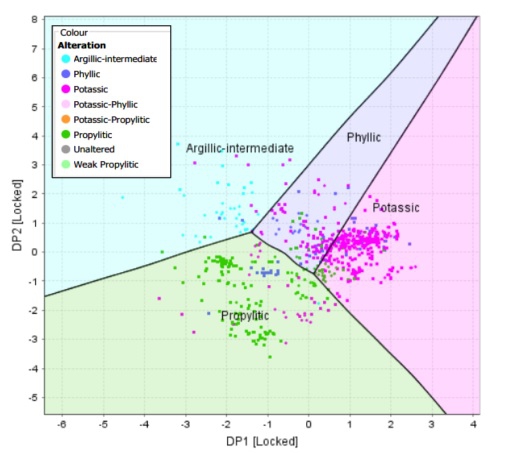
Hydrothermal magnetitie derived from different PCD alteration domains can readily be discriminated potentially providing a vector to the metal shells of commercial interest. (Sievwright 2017)
Fertility Indicators of Magmatic and Hydrothermal Systems
8:30am – 1:00pm, Monday 27th of May 2019 Australian Resources Research Centre (ARRC) 26 Dick Perry Avenue, Kensington, WA 6151
Discovery of new deposits is costly and challenging, particularly when exploration is now moving under cover and being more predictive can be the immediate key to discovery. Chemical fingerprinting and fertility assessment of rocks and minerals related to potential exploration targets at different scales have gained a lot of momentum in the last decade. In this workshop leading geoscientists from industry, government and academia share the latest advances in fertility indicators of magmatic and hydrothermal systems, which have the potential to lead to Tier 1 discovery in the future..
Program
08:00 – 08:30 Registrations
08:30 – 08:40 Introduction
08:40 – 09:20 Steve Rowins (CET) An apatite for exploration: the use of detrital minerals and soil geochemistry in the search for buried mineralisation
09:20 – 10:00 Yongjun Lu (GSWA) Zircon fingerprinting of magmatic-hydrothermal systems in Archean Craton and Phanerozoic terranes
10:00 – 10:40 Matt Loader (Natural History Museum, UK) Zircon and apatite as indicators of porphyry Cu deposit fertility
10:40 – 11:10 Morning Tea
11:10 – 11:50 Louise Schoneveld (CSIRO) Indicator minerals for magmatic Ni-Cu sulphide mineralisation
11:50 – 12:30 Paul Agnew (Rio Tinto) Porphyry Fertility – An industry perspective
The conference will address advances and breakthroughs in understanding the setting, genesis and characteristics of magmatic systems related to Sn-W-Critical Metal mineralisation, including Rare Metal Pegmatites. The program will feature presentations from world-class researchers in the field, including:
Rolf Romer (GFZ, Potsdam, Germany)
Jingwen Mao (Chinese Academy of Geological Sciences, Beijing, China)
Shao-Yong Jiang (China University of Geosciences, Wuhan, China)
Dr Phillip Blevin (Mineral Systems, Geological Survey of NSW, Maitland, Australia)
Zhaoshan Chang (Colorado School of Mines, Denver, USA)
David Cooke (CODES, Hobart, University of Tasmania)
Dr Peter Pollard (Pollard Geological Services, Brisbane, Australia)
Dr Yanbo Cheng (EGRU, James Cook University, Townsville, Australia)
See you at the event – should be well worth attending. If anyone is interested in a little pre-confernece rainforest hiking for 2-3 days before the event – message me.
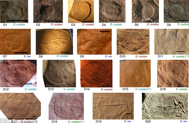
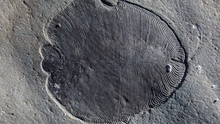
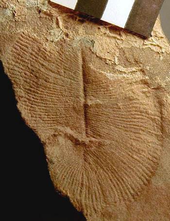
A recent paper in Science authored Ilya Bobrovskiy, Janet Hope and colleagues from ANU, the Russian Academy and European institutions has remarkably (and convincingly) discovered molecules of fat in Dickinsonia, a marine genus of the Ediacaran biota.
Dikinsonia samples from Quantitative study of developmental biology confirms Dickinsonia as a metazoan , Renee S. Hoekzema, Martin D. Brasier, Frances S. Dunn, Alexander G. Liu proceedings of The Royal Society. Published 13 September 2017.DOI: 10.1098/rspb.2017.1348
This has confirmed that the 558 million year old Dickinsonia is the earliest animal in the geological record and maybe a presursor to – you!
Organically preserved Dickinsonia fossil from the White Sea area of Russia. A Dickinsonia fossilILYA BOBROVSKIY / AUSTRALIAN NATIONAL UNIVERSITY
The strange creature called Dickinsonia, which grew up to 1.4 metres in length and was oval shaped with rib-like segments running along its body, was part of the Ediacara Biota that lived on Earth 20 million years prior to the ‘Cambrian explosion’ of modern animal life. The Ediacara biota are a diverse assemblage of macroscopic body forms that appear in the sedimentary rock record between 570 million and 541 million years ago. First recognized in Namibia and Australia, these remarkable organisms have since been found in Russia, China, Canada, Great Britain, and other regions. Although they immediately preceded the rapid appearance and diversification of animals in the Cambrian (541 million to 485 million years ago), their position within the tree of life has long been a puzzle. Some Ediacaran fossils appear segmented, but most lack obvious characters such as appendages, a mouth, or a gut that might link them to animal clades.
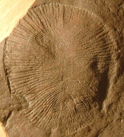
Dickinsonia costata (~7.7 cm long), SAM P13750/P40679 (South Australian Museum, Adelaide, Australia)
Prior to this study Dikinsonia affinities were unknown and while its mode of growth is consistent with a bilaterian affinity some thought that it belong to to the fungi, or even an “extinct kingdom”
Dickinsonia costata (centimeter scale), YPM 35467 (Yale University’s Peabody Museum, New Haven, Connecticut, USA)
Bobrovskiy et al. conducted an analysis using lipid biomarkers obtained from Dickinsonia fossils and found that the fossils contained almost exclusively cholesteroids, a marker found only in animals. Thus, Dickinsoniawere basal animals. This supports the idea that the Ediacaran biota may have been a precursor to the explosion of animal forms later observed in the Cambrian, about 500 million years ago.
Obtaining evidence of cholesteroids first involved finding exceptionally well preserved fossils. The Dikinsonia fossils used in this study came from a narrow strata in the remote White Sea are of Russia.
Lead senior researcher Associate Professor Jochen Brocks said the ‘Cambrian explosion’ was when complex animals and other macroscopic organisms—such as molluscs, worms, arthropods and sponges—began to dominate the fossil record.
“The fossil fat molecules that we’ve found prove that animals were large and abundant 558 million years ago, millions of years earlier than previously thought,” said Associate Professor Jochen Brocks from the ANU Research School of Earth Sciences.
“Scientists have been fighting for more than 75 years over what Dickinsonia and other bizarre fossils of the Edicaran Biota were: giant single-celled amoeba, lichen, failed experiments of evolution or the earliest animals on Earth. The fossil fat now confirms Dickinsonia as the oldest known animal fossil, solving a decades-old mystery that has been the Holy Grail of palaeontology.”
Abstract
The enigmatic Ediacara biota (571 million to 541 million years ago) represents the first macroscopic complex organisms in the geological record and may hold the key to our understanding of the origin of animals. Ediacaran macrofossils are as “strange as life on another planet” and have evaded taxonomic classification, with interpretations ranging from marine animals or giant single-celled protists to terrestrial lichens. Here, we show that lipid biomarkers extracted from organically preserved Ediacaran macrofossils unambiguously clarify their phylogeny. Dickinsonia and its relatives solely produced cholesteroids, a hallmark of animals. Our results make these iconic members of the Ediacara biota the oldest confirmed macroscopic animals in the rock record, indicating that the appearance of the Ediacara biota was indeed a prelude to the Cambrian explosion of animal life.
Geological Belts, Plate Boundaries and Mineral Deposits in Myanmar
Just received the above titled book from Elsevier for review. I had the great pleasure of spending some time in the field in Myanmar with Andrew Mitchell in 2017 and this important contribution by him is a remarkable testament to his life’s work. He has enormous knowledge of the geology and mineral deposits of Myanmar and that is obvious in this text.
I will be undertaking a chapter-by-chapter review of the text over the coming 6 weeks or so and posting here. A quick review: The text is well written, beautifully presented and the numerous maps provide new geological insights. As a largely personal contribution this is an unusual work and will be important to minerals industry professionals and researchers and importantly, geoscience educators in Myanmar.
Geological Belts, Plate Boundaries and Mineral Deposits in Myanmar arms readers with a comprehensive overview of the geography, geology, mineral potential and tectonic plate activity of Myanmar. The book focuses on the nature and history of the structural belts and terranes of Myanmar, with particular emphasis on the mineral deposits and their relationship to stratigraphy and structure. The country has a long history of plate tectonic activity, and the most recent plate movements relate to the northward movement of the India plate as it collides with Asia. Both of these are responsible for the earthquakes which frequently occur, making the country a geologically dynamic region. Additionally, Myanmar is rich in mineral and petroleum potential and the site of some of Southeast Asia’s largest faults. However, many geoscientists are only recently becoming familiar with Myanmar due to previous political issues. Some of these barriers have been removed and there is emerging international interest in the geology and mineral deposits of Myanmar. This book collates this essential information in one complete resource. Geological Belts, Plate Boundaries and Mineral Deposits in Myanmar is an essential reference for economic geologists, mineralogists, petroleum geologists, and seismologists, as well as geoscience instructors and students taking related coursework.
Remarkably the ESA Swarm satellite constellation data has yielded evidence of a very weak but not unsurprising magnetic field generated by the movement of planetary scale oceanic currents. The signal strength is however exceedingly weak and being 20,000 times less than the lithospheric signature took four years of data to elucidate.
When salty ocean water flows through Earth’s magnetic field, an electric current is generated, and this, in turn, induces a magnetic signal. However, the field generated by tides is tiny and extremely difficult to measure – but Swarm has done just this in remarkable detail. (see the above video).
Nils Olsen, from the Technical University of Denmark, said, “We have used Swarm to measure the magnetic signals of tides from the ocean surface to the seabed, which gives us a truly global picture of how the ocean flows at all depths – and this is new.
“Since oceans absorb heat from the air, tracking how this heat is being distributed and stored, particularly at depth, is important for understanding our changing climate.
“In addition, because this tidal magnetic signal also induces a weak magnetic response deep under the seabed, these results will be used to learn more about the electrical properties of Earth’s lithosphere and upper mantle.”
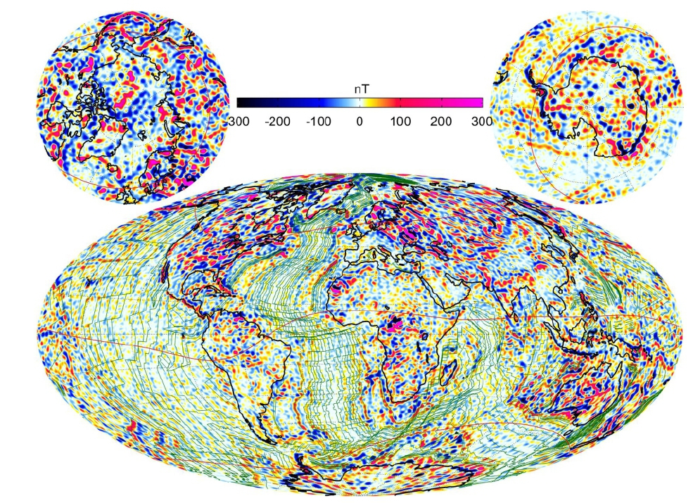
ESA has just released the most detail magnetic data on the lithosphere from its Swarm three satellite constellation. Launched on 22 November 2013, Swarm is the fourth in a series of pioneering Earth Explorer research missions, following on from GOCE, SMOS and CryoSat. Is also ESA’s first constellation of satellites to advance our understanding of how Earth works.
This is the most detailed map ever of the tiny magnetic signals generated by Earth’s lithosphere. The map, a video of which is seen here. The data is being used to understand more about Earth’s geological history, is thanks to four years’ of measurements from ESA’s trio of Swarm satellites, historical data from the German CHAMP satellite and observations from ships and aircraft.
Erwan Thebault from the University of Nantes in France said, “This is the highest resolution model of the lithospheric magnetic field ever produced. “With a scale of 250 km, we can see structures in the crust like never before. And, we have gained even finer detail in some parts of the crust, such as beneath Australia, where measurements from aircraft have mapped at resolution of 50 km.
“This combined use of satellite and near-surface measurements gives us a new understanding of the crust beneath our feet, and will be of enormous value to science.”
Map of field vertical component Z, at the Earth’s surface from the LCS-1 model for spherical harmonic degrees n-16-185. Green lines are isochrones.
Most of Earth’s magnetic field is generated deep within the outer core by an ocean of superheated, swirling liquid iron, but there are also much weaker sources of magnetism. The Swarm constellation has been used to yield some discoveries about these more elusive signals, such as that from Earth’s lithosphere. A small fraction of the magnetic field comes from magnetised rocks in the upper lithosphere, which includes Earth’s rigid crust and upper mantle. This lithospheric magnetic field is very weak and therefore difficult to detect from space. As new oceanic crust is created through volcanic activity, iron-rich minerals in the upwelling magma are oriented to magnetic north at the time and solidified as the magma cools. Since magnetic poles flip back and forth over time, the solidified magma due to mantle upwelling at mid-oceanic ridges forms magnetic ‘stripes’ on the seafloor which provide a record of Earth’s magnetic history. These magnetic imprints on the ocean floor can be used as a sort of time machine, allowing past field changes to be reconstructed and showing the movement of tectonic plates from hundreds of million years ago until the present day.