Chris Harrison from Department of Marine Geosciences, Rosenstiel School of Marine and Atmospheric Science, University of Miami in a paper in Earth, Planets and Space has sought to resolve the question of the number plates that make up the surface of the earth.
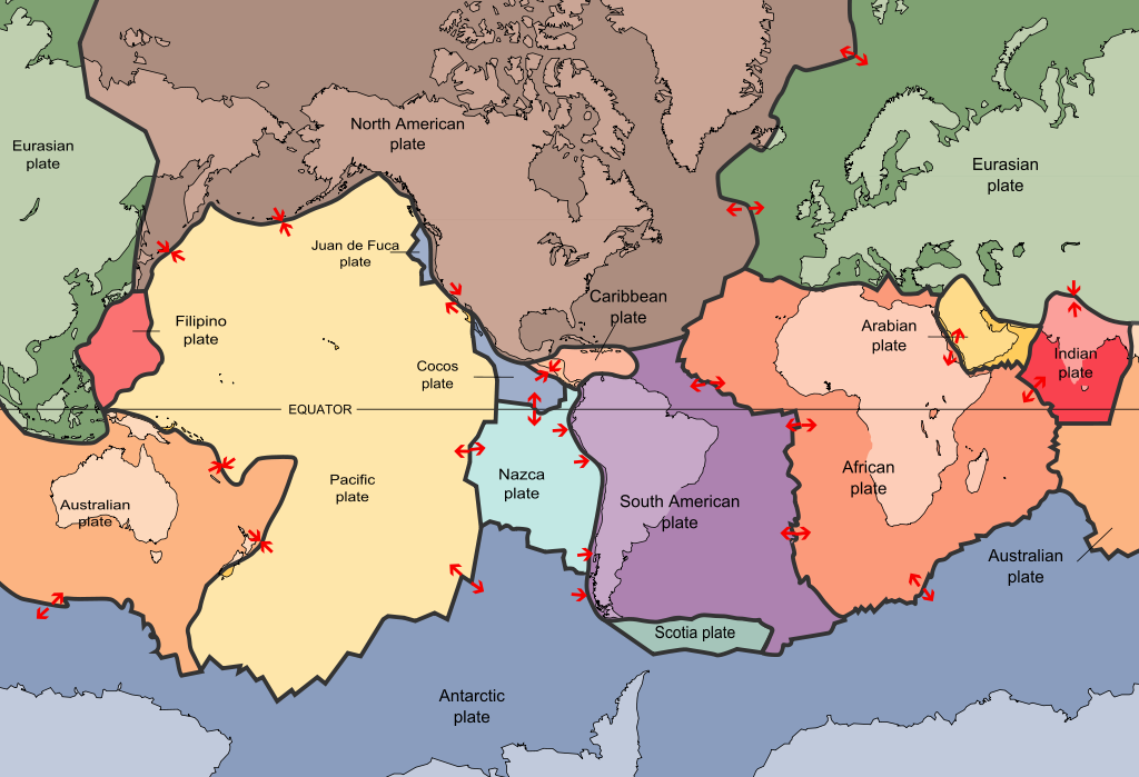
The number of tectonic plates on Earth described in the literature has expanded greatly since the start of the plate tectonic era, when only about a dozen plates were considered in global models of present-day plate motions. With an ever-increasing number of earthquake monitoring sites, improving ocean bathymetry using swath mapping, and the use of space based geodetic techniques, there has been a huge growth in the number of plates thought to exist. In 2003 the total was thought to be 52 delineated on the basis of earthquake epicentre data.
Chris now proposes a total of 159 plates (with some additional smaller plates yet to be mapped).
The largest plate (Pacific) is about 20 % of the Earth’s area or 104 million km2, and the smallest plate is only 273 km2. The Earth is continuously evolving with the continuous creation of new oceanic crust and its destruction in subduction zones. This has a very significant impact on the distribution of continents, movement of water within the worlds oceans (over time) and plays an important part in the evolution of life on this planet.
REF: The present-day number of tectonic plates, Earth, Planets and Space 2016, 68:37. Download PDF
Abstract
The number of tectonic plates on Earth described in the literature has expanded greatly since the start of the plate tectonic era, when only about a dozen plates were considered in global models of present-day plate motions. With new techniques of more accurate earthquake epicenter locations, modern ways of measuring ocean bathymetry using swath mapping, and the use of space based geodetic techniques, there has been a huge growth in the number of plates thought to exist. The study by Bird (2003) proposed 52 plates, many of which were delineated on the basis of earthquake locations. Because of the pattern of areas of these plates, he suggested that there should be more small plates than he could identify. In this paper, I gather together publications that have proposed a total of 107 new plates, giving 159 plates in all. The largest plate (Pacific) is about 20 % of the Earth’s area or 104 Mm2, and the smallest of which (Plate number 5 from Hammond et al. 2011) is only 273 km2 in area. Sorting the plates by size allows us to investigate how size varies as a function of order. There are several changes of slope in the plots of plate number organized by size against plate size order which are discussed. The sizes of the largest seven plates is constrained by the area of the Earth. A middle set of 73 plates down to an area of 97,563 km2 (the Danakil plate at number 80, is the plate of median size) follows a fairly regular pattern of plate size as a function of plate number. For smaller plates, there is a break in the slope of the plate size/plate number plot and the next 32 plates follow a pattern of plate size proposed by the models of Koehn et al. (2008) down to an area of 11,638 km2(West Mojave plate # 112). Smaller plates do not follow any regular pattern of area as a function of plate number, probably because we have not sampled enough of these very small plates to reveal any clear pattern.