January 27, 2020
Mapped Arctic sea ice extent (SIE) on 25/01/2020 was 14.11 million km2 which is 420,000 km2 or 2.9% less than the 2008-2018 median. This is largest sea ice extent on this day since 2014. The current sea ice accumulation rate is 65,000 km2/day, the fifth highest since 1979.
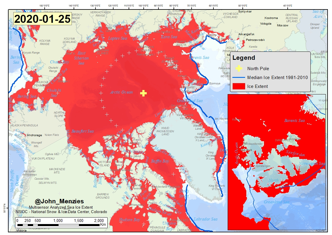
Figure 1 MASIE Arctic Sea Ice Extent and SIE Median for the period 1981-2010
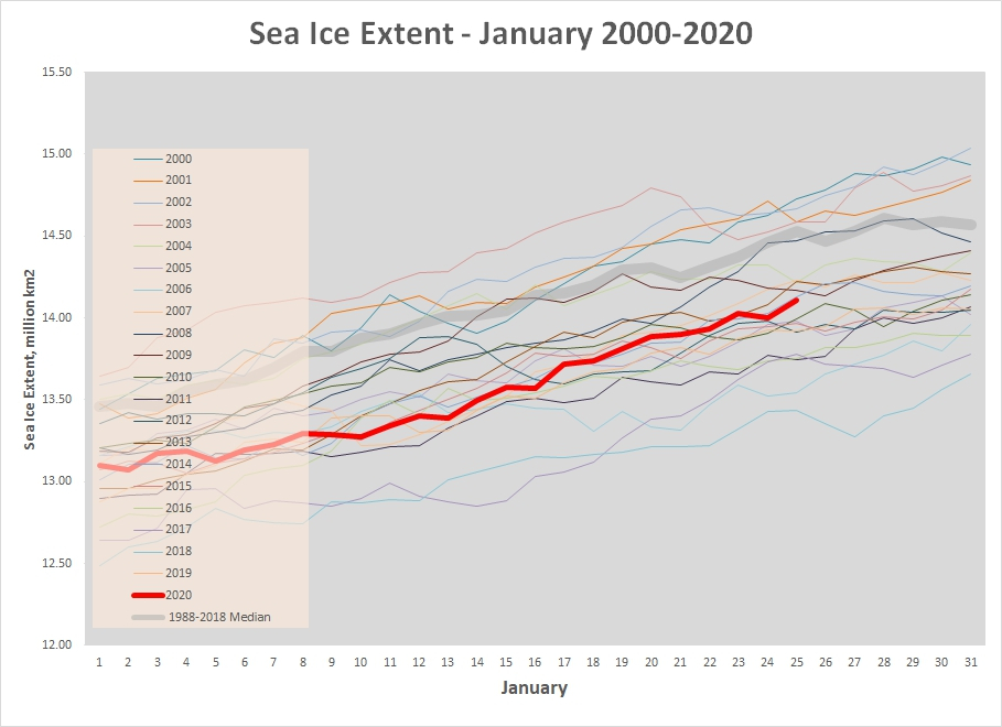
Figure 2 Arctic Sea Ice Extent (MASIE Database – see above image) for the month of January for the period 2000-2020 with the 1988-2018 median
The extent of Arctic sea ice varies from summer to winter. The sea ice extent shown here relies on data from the Multisensor Snow and Ice Mapping System (IMS) that runs at the National Ice Center. The IMS product uses several satellite data sources including passive microwave, but it is also based on visual analysis and other data sources and undergoes a form of manual data fusion. The data reported here has a 1 km resolution and was sourced from the National Snow and Ice Data Center